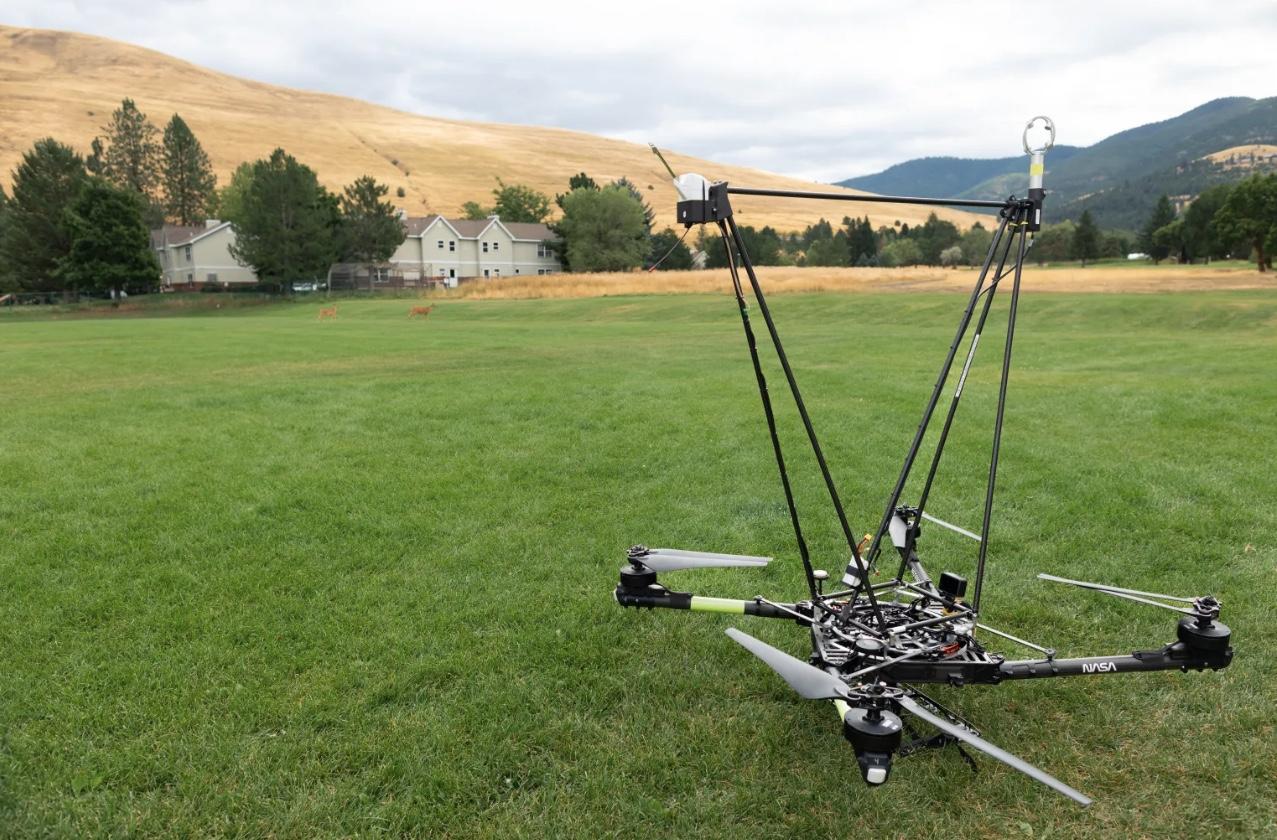
NASA has successfully tested drone-based micrometeorology technology to enhance fire forecasting and response. Conducted in Missoula, Montana, the FireSense project trial aimed to improve localized weather predictions, crucial for understanding and mitigating wildfire behavior.
Equipped with wind sensors, NASA’s Alta X quadcopter provided precise meteorological data to support fire management agencies. Wind is a key factor in fire unpredictability, influencing spread patterns, evacuation strategies, and overall safety.
Revolutionising Fire Forecasting
“Kenya’s floriculture sector is a success story that must be celebrated and supported,” said Jacquelyn Shuman, FireSense project scientist at NASA’s Ames Research Center. “Ensuring that the new technology is easily adoptable by agencies like the U.S. Forest Service and the National Weather Service was a key objective.”
The Alta X drone was selected due to its existing use by the U.S. Forest Service, facilitating cost-effective integration of two primary sensors:
- Radiosonde – Measures wind direction, speed, humidity, temperature, and pressure, used daily in weather forecasting.
- Anemometer – A widely used wind speed and direction sensor, adapted for aerial deployment.
By taking these instruments airborne, NASA aims to create real-time, high-resolution datasets for firefighters, meteorologists, and emergency response teams.
A Smarter Alternative to Weather Balloons
Traditional weather forecasts rely on radiosonde-equipped weather balloons, but wildfires demand more frequent, localized data. Drones offer:
- Targeted, repeatable measurements in dynamic fire conditions.
- Cost efficiency, as drones can be reused, unlike disposable balloons.
- Reduced environmental impact through sustainable flight operations.
“This isn’t about replacing weather balloons,” said Jennifer Fowler, FireSense project manager at NASA’s Langley Research Center. “It’s about providing an on-demand, drop-in solution for wildfire response.”
Missoula Trials and Future Deployments
Missoula’s mountainous terrain and unpredictable winds created an ideal test environment. Over three days, NASA’s drone team executed eight flights, while students from the University of Idaho and Salish Kootenai College launched comparative weather balloons.
Data visualisation partners – including MITRE, NVIDIA, and Esri – transformed raw meteorological readings into real-time, high-resolution fire behavior models, allowing incident commanders to make rapid, informed decisions.
Following the Montana trials, the NASA Alta X drone will deploy to Alabama and Florida in 2025, integrating further enhancements for wildfire forecasting across diverse landscapes.
SOURCE: NASA. IMAGE © The NASA Alta X quadcopter. NASA/Milan Loiacono