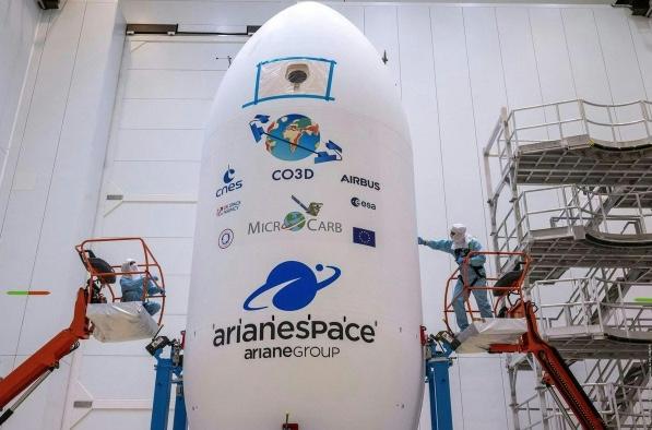
Toulouse, France – 26 July 2025 – Airbus has confirmed the successful deployment of its four-satellite CO3D (Constellation Optique 3D) system into Sun-synchronous orbit, following a precise launch aboard an Arianespace Vega-C rocket from the European Spaceport in Kourou, French Guiana. Developed in collaboration with the French Space Agency (CNES), this next-generation satellite constellation is now preparing to generate a high-resolution, three-dimensional map of the Earth.
Each of the four 285 kg CO3D satellites will contribute to a global Digital Surface Model (DSM) offering 50 cm stereo imagery to CNES and 2D imagery to a range of commercial and government users. Operating at an altitude of 502 km, the satellites will undergo in-orbit commissioning over the next six months before beginning an 18-month mapping mission, initially focused on France and key geostrategic regions known as the ‘crisis arc’.
Alain Fauré, Head of Space Systems at Airbus, hailed the launch as a “major step forward in our first-class Earth observation capabilities,” adding that the CO3D programme exemplifies the synergy between European space engineering and strategic data applications.
Built on Airbus’s S250 platform, the satellites incorporate a novel “Step and Stare” imaging mode. This allows each satellite to rapidly shift (Step) and then capture high-resolution imagery (Stare) in swaths of 7 km × 5 km—extendable to 28 km—thanks to enhanced onboard agility. These capabilities enable rapid revisits and dense coverage, crucial in both military and civilian applications such as urban development, hydrology, geology, and disaster response.
The spacecraft were assembled on a digitalised, automotive-inspired production line in Toulouse, leveraging Airbus’s experience with OneWeb satellite manufacture. A number of commercial off-the-shelf components have been space-qualified for the mission, providing an optimal balance between performance and reliability.
The launch also included the successful deployment of the CNES–UK Space Agency’s MicroCarb satellite, built by Airbus. Equipped with a precision spectrometer, MicroCarb will chart global atmospheric carbon dioxide concentrations, supporting international climate monitoring efforts.
As demand grows for geospatial intelligence in both strategic and scientific domains, the CO3D constellation is poised to become a cornerstone of European Earth observation capability.
SOURCE : AIRBUS IMAGE: Copyright CNES/ESA/Arianespace/optique video CSG/S Martin 2025