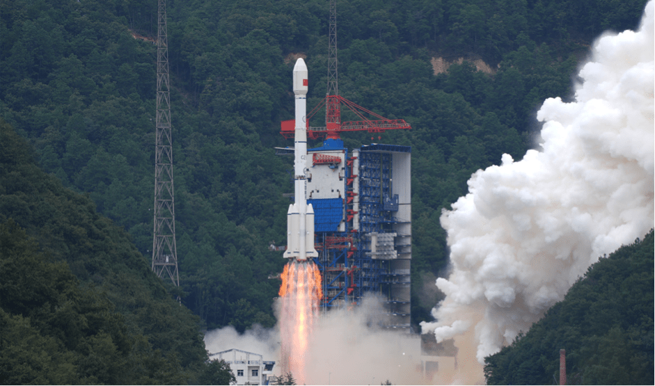
BEIJING – China successfully launched the Gaofen-14 02 Earth observation satellite into its planned orbit on October 26, 2025, from the Xichang Satellite Launch Center. Carried by a Long March-3B rocket, the satellite’s primary mission is to enhance global high-precision 3D mapping for both economic and national defence applications.
This launch, the 603rd flight for the Long March rocket series, is a significant step for China’s expanding space program. According to official reports, the satellite will provide high-quality stereo imagery to support a range of civilian functions, including:
- Topographical mapping:Producing large-scale digital topographic maps, digital elevation models, and digital surface models.
- Environmental monitoring:Tracking air and water quality, inventorying natural resources, and aiding in climate change studies.
- Urban planning:Supporting city development and planning road networks.
- Belt and Road Initiative:Providing geographic information for major economic projects.
However, the explicitly stated purpose of supporting “national defence construction” has raised concerns among some international observers regarding the satellite’s potential military applications. This scrutiny is particularly intense following reports of China allegedly providing satellite reconnaissance data to Russia for use in the conflict in Ukraine. The Chinese Ministry of Foreign Affairs has denied these claims, stating that Beijing maintains a “fair and objective stance” on the conflict.
In a separate development also on October 27, an Australian company specialising in satellite imaging, HEO, publicised new details about an older Chinese test satellite, the XJY-7. The XJY-7 was launched in 2020 on the debut flight of the Long March 8 rocket. HEO’s analysis, made possible through satellite-to-satellite imaging, revealed that the spacecraft was equipped with a deployed synthetic aperture radar (SAR) antenna, confirming the nature of the “mystery” technology test satellite.
The dual announcements on consecutive days underscore China’s rapid advancements in space technology, highlighting both its growing capabilities and the dual-use nature of its satellite infrastructure. While advancements in Earth observation satellites promise significant civilian benefits, they also contribute to the country’s military intelligence and reconnaissance capabilities.