
A twelve-month drone demonstration project in Michigan’s Upper Peninsula has completed its live flight phase, validating integrated UTM and Counter-UAS digital services for commercial and public safety BVLOS operations adjacent to the US-Canada border and within one of the United States’ most complex and regulated flight environments.
FIRST UNIFIED DIGITAL AIRSPACE DEMONSTRATION NEAR AN INTERNATIONAL BORDER
ANRA Technologies, the Chippewa County Economic Development Corporation (CCEDC), and a coalition of industry, utility, aviation, research and technology partners have announced the successful completion of the live demonstration phase of the Chippewa County Drone Project — a twelve-month initiative funded through Michigan’s Office of Future Mobility and Electrification (OFME) and the Michigan Mobility Funding Platform. Live demonstrations were conducted across the week of 15 to 18 June 2026, validating how digital airspace infrastructure can safely support advanced BVLOS drone operations in a complex, near-border operational environment.
The project’s operational complexity was exceptional. Flight activities required the coordination and approval of the Federal Aviation Administration, NAV Canada, Chippewa County International Airport and the Kinross Correctional Facility, the latter posing particular regulatory and procedural challenges given its designation as a sensitive security facility. That the approvals were secured and operations successfully completed in this environment is presented by the project partners as a model for how correctional authorities, airport stakeholders, US and Canadian aviation regulators and industry partners can collaborate to enable advanced drone operations in highly regulated, near-border environments.
TECHNICAL INFRASTRUCTURE: UTM, COUNTER-UAS AND THE SOO LOCKS
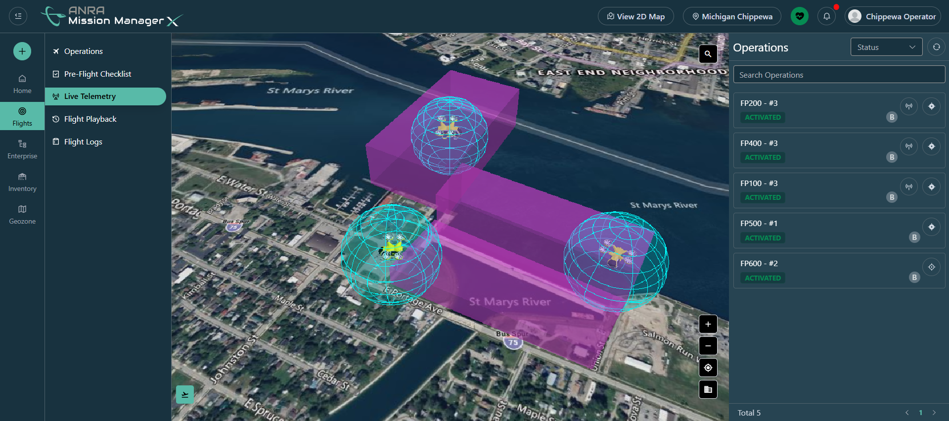
ANRA Technologies provided the FAA-approved UAS Traffic Management (UTM) platform and Single Integrated Operational Picture (SIOP) that served as the operational backbone of the demonstration. A defining technical achievement was the integration of UTM and Counter-UAS (C-UAS) situational awareness into a unified Common Operating Picture, combining cooperative flight data from authorised aircraft with radio frequency detection technology from Guardian RF and optical surveillance data from Lighthouse Avionics. This fusion enabled authorities responsible for protecting the Soo Locks — strategically critical infrastructure whose drone no-fly zone formed a direct constraint on the demonstration airspace — to distinguish in real time between approved commercial operators and unknown or unauthorised aircraft, without disrupting legitimate commercial activity.
Partner organisations brought a range of real-world commercial and public safety applications to the demonstration. Censys Technologies conducted infrastructure inspection flights; Michigan Tech Research Institute supported aerial inspections of the Tower of History and railroad research assets; Cloverland Electric Cooperative enabled utility inspection demonstrations at its St. Marys Falls Hydropower Plant; and RIIS LLC conducted flight operations around the Kinross Correctional Facility, validating detection, identification and tracking capabilities for security-sensitive environments. All partner organisations — including Cloverland Electric Cooperative, Lighthouse Avionics and Guardian RF — participated voluntarily without direct project funding, which the CCEDC describes as a meaningful indicator of genuine industry confidence in the region’s emerging drone ecosystem.
TOWARDS PART 108 AND A REGIONAL BVLOS HUB
Amit Ganjoo, Founder and CEO of ANRA Technologies, said the project demonstrated how digital airspace infrastructure could safely support advanced drone operations in a complex operational environment, and that successfully deploying ANRA’s interoperable digital services for UTM and integrated airspace awareness was another illustration of how vendor lock-in could be prevented while enabling all commercial operations and enhancing security around critical infrastructure. Chris Olson, President of the CCEDC, said the project had moved beyond research to demonstrate commercially viable drone operations in a real-world environment and created a foundation for future investment, new business opportunities, workforce development and long-term economic growth across the region.
The Chippewa County Drone Project also positions the region directly in relation to the FAA’s proposed Part 108 and Part 146 framework, which envisages Advanced Digital Service Providers delivering interoperable digital services for routine BVLOS operations. ANRA says the services demonstrated at Chippewa County — strategic coordination, conflict management, conformance monitoring, integrated C-UAS awareness and cross-border regulatory coordination — align closely with the capabilities envisaged in that framework.
Source and Images: ANRA Technologies / Chippewa County Economic Development Corporation