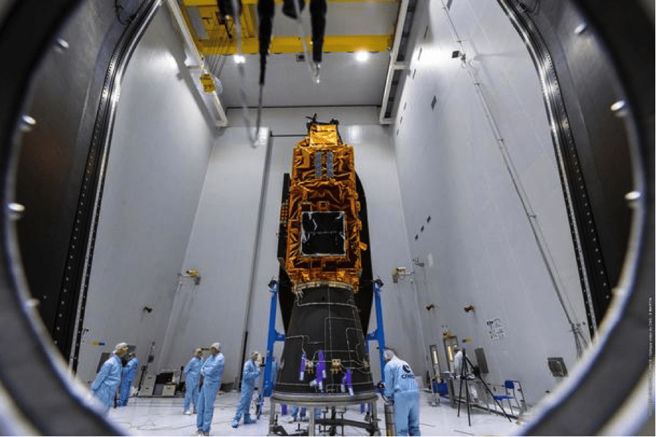
Toulouse, France, 29 April 2025 – The Airbus-built Biomass satellite has successfully launched into orbit, marking a significant step forward in the global effort to monitor forests and better understand the planet’s carbon cycle.
A flagship mission under the European Space Agency’s (ESA) Earth Explorer programme, Biomass was lifted into space aboard a Vega-C rocket from Europe’s Space Port in Kourou, French Guiana. Now safely in orbit at an altitude of 666 kilometres, the satellite embarks on a five-year mission to deliver unprecedented data on the world’s forests.
“Biomass will give scientists and climatologists unprecedented data on the state of the world’s forests, further enhancing the understanding of the climate cycle. The spacecraft is now safely in orbit and ready to deliver its precious data,” said Alain Fauré, Head of Space Systems at Airbus Defence and Space.
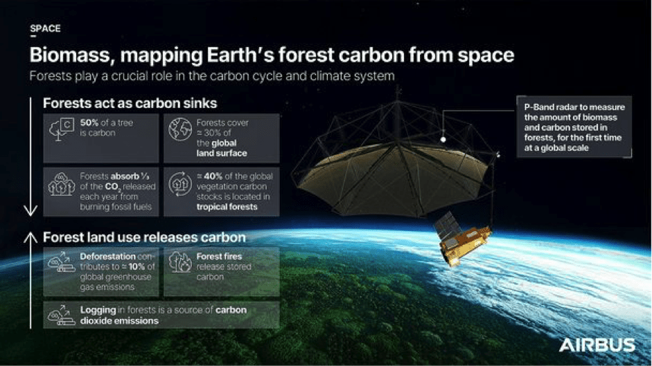
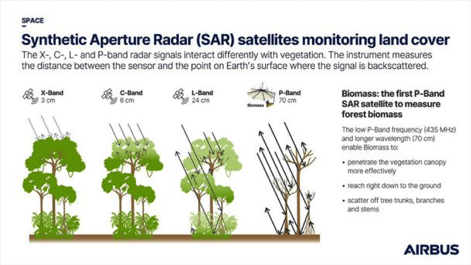
At the heart of Biomass is its revolutionary P-band synthetic aperture radar (SAR) instrument—the first of its kind in space. This powerful radar will penetrate forest canopies to map tropical, temperate, and boreal forest biomass with exceptional accuracy. These maps will enable scientists to better assess terrestrial carbon stocks and fluxes, crucial for understanding the role forests play in regulating climate and informing global efforts to combat climate change.
In addition to its primary mission, Biomass will contribute to studies of ice sheet dynamics, subsurface geology, and topography. Its ability to detect paleo aquifers offers potential to locate new water sources in arid regions, expanding the satellite’s impact beyond forest monitoring.
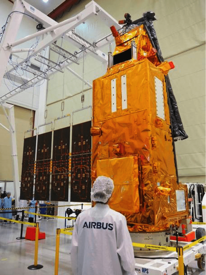
Equipped with a 12-metre deployable antenna, Biomass will capture reflected SAR signals to track forest changes, from deforestation and logging to regrowth. The spacecraft was developed, built, and tested across Airbus facilities in Stevenage (UK), Friedrichshafen (Germany), and Toulouse (France), before shipment to French Guiana earlier this year.
Development involved more than 50 companies across 20 countries, underscoring Europe’s collaborative investment in climate research. Ground calibration will be managed from New Norcia, Australia, ensuring the accuracy of the data collected.
Biomass’ data will also support REDD+—the United Nations initiative aimed at reducing emissions from deforestation and forest degradation—by enabling systematic monitoring without the need for ground intervention.
With this milestone launch, Biomass is set to deliver critical insights that will strengthen climate policy, guide conservation efforts, and improve understanding of Earth’s complex environmental systems.